The Problem: A Listing Is Not an Address
Rental platforms know exactly where their properties are, but they generally don’t show that information to regulators.
A city may know that hundreds or thousands of Airbnb and Vrbo listings operate within its limits and still have no way to connect each listing to a physical property.
VeriStay is built to close that gap. It combines automated listing collection, the municipality’s parcel and registration data, identification by an analyst, automatic license matching and a second review in one workflow.
The goal
Find the exact address and parcel of each listing, backed by evidence, and determine whether the property meets the municipality’s STR requirements.
Step 1: Listings Are Collected Automatically
For each municipality we work with, listings are collected automatically from rental platforms such as Airbnb and Vrbo.
The collected information can include:
- Listing URL
- Listing title
- Host information
- Listing photos
- Approximate location
- Property details
- Other information the platform makes available
Municipal staff don’t need to search the rental sites themselves. The listings are already collected and waiting for review when identification starts.
Step 2: Each Listing Goes to an Analyst
Each unidentified listing is assigned to an analyst in VeriStay.
The analyst works from more than the Airbnb link. Their workspace shows:
- The original listing
- Listing photos
- Host name
- Listing title and details
- Municipal parcel data
- A parcel map
- Pins for nearby parcels, with each parcel’s details
- A form for submitting the identified address and parcel
All of it is there to answer one question:
Where exactly is this rental?
Sometimes the answer is obvious. Other times it takes several pieces of evidence.
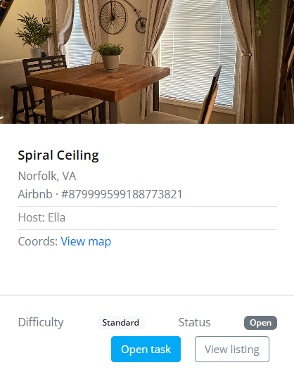
Analyst Solve View (Partial View)
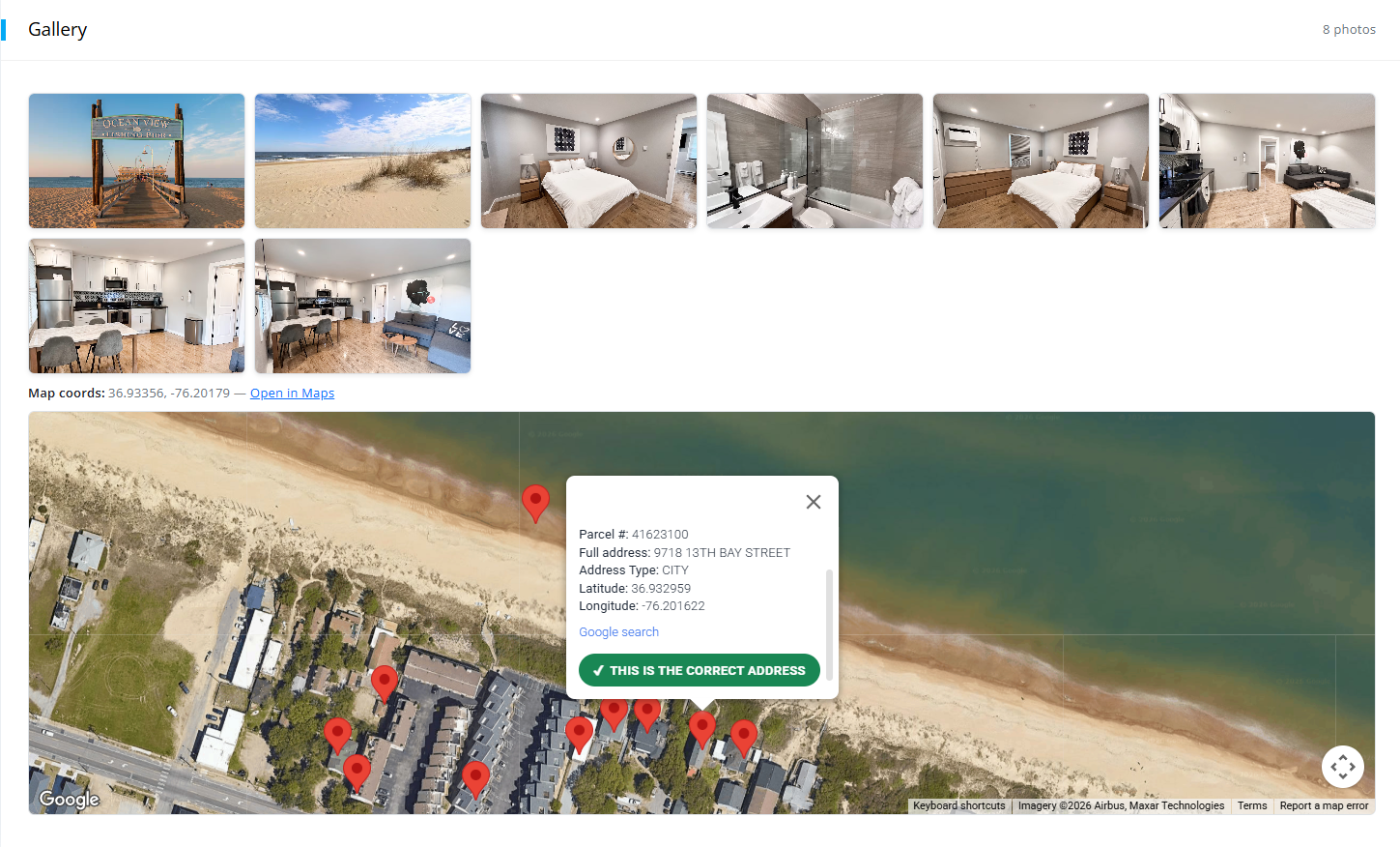
The map uses parcel data provided by the municipality. When a listing is opened, the map centers on the rental’s estimated location and shows nearby parcels as pins the analyst can search.
For example, if an exterior photo shows a visible house number, the analyst can type that number into the map filter to show only nearby parcels with that number.
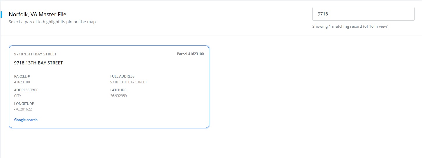
If only one nearby parcel matches, the analyst has a strong candidate in the right area. The address is then confirmed with other evidence, using methods like the ones below.
Step 3: The Analyst Picks an Identification Method
No single technique works for every listing.
The method depends on the evidence the listing provides. A single-family home with clear exterior photos calls for a different approach than a condominium with only interior photos.
Example: Matching a Home Through Real Estate Photos
Take an Airbnb listing for an entire single-family home.
If the listing has a clear exterior photo, a reverse image search is often a good start. It may turn up a real estate listing or another public source that shows the same house with its street address.
The analyst compares the rental’s photos with the property photos. When they match, the listing can be tied to a specific property within minutes.
STR photo → matching real estate photo → exact address → municipal parcel
The address is then checked against the municipality’s parcel data in VeriStay.
Airbnb Listing: Exterior Photo
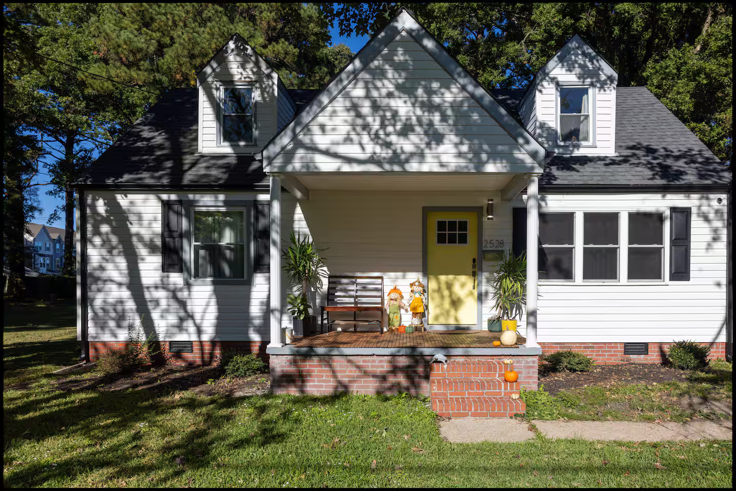
Real Estate Listing on movoto.com: Matching Exterior and Address
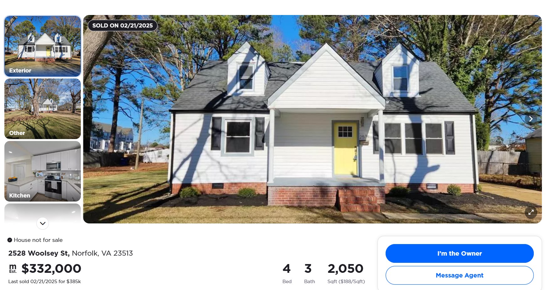
https://www.movoto.com/norfolk-va/2528-woolsey-st-norfolk-va-23513/pid_r0cn5ppaph/
Example: Matching a Property From Satellite Imagery
Satellite imagery is another good way to identify detached homes.
If the approximate location is known and the imagery is clear, the analyst can compare features in the listing with the properties in that area, such as:
- Roof shape
- Pool shape
- Driveway layout
- Building footprint
- Decks and patios
- Sheds and other outbuildings
- Landscaping and trees
- Lot shape
Together, details like an unusual pool, a particular roofline and a curved driveway can rule out every other parcel nearby.
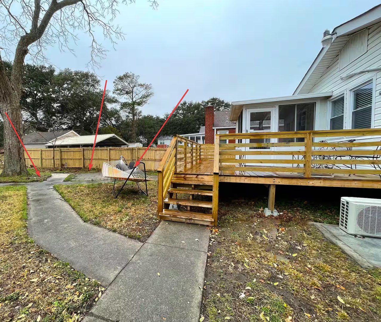
Backyard Photo From the Host on Airbnb
Google Maps Imagery of the Same Property
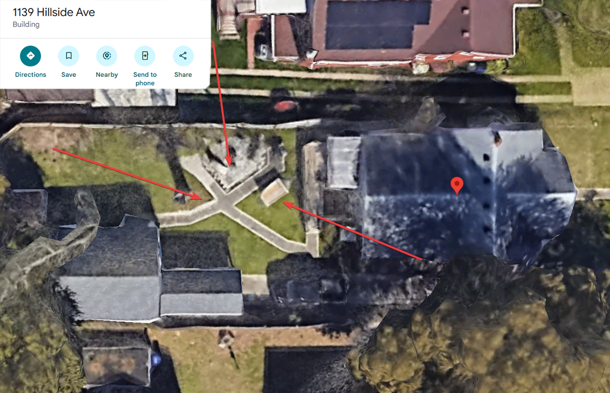
In this example, the host’s backyard photo and the Google Maps satellite image share a crossing walking path, a patch of weathered stonework and a hammock.
Identifying the Exact Unit
Apartment and condominium buildings are harder. Finding the right building may not be enough, because a building can have dozens or hundreds of units and only one of them is the rental.
VeriStay can sometimes identify the exact unit.
Units often share a layout, but photos can still show details that only one unit has, for example:
- Wood grain
- Natural stone patterns, such as on a fireplace
- Flooring
- Countertop veining
- The view and window positions
- Permanent fixtures
Natural materials work like fingerprints.
Two units can have the same floor plan, cabinets, appliances and fireplace, but the grain of a piece of wood or the pattern of a stone is unique to each one.
If photos of a specific unit exist, for example from an old real estate listing, those details can show that the rental photos and the unit photos are of the same interior. So even in a building of similar units, a listing can often be traced to one unit.
Interior Photo From the Host on Airbnb
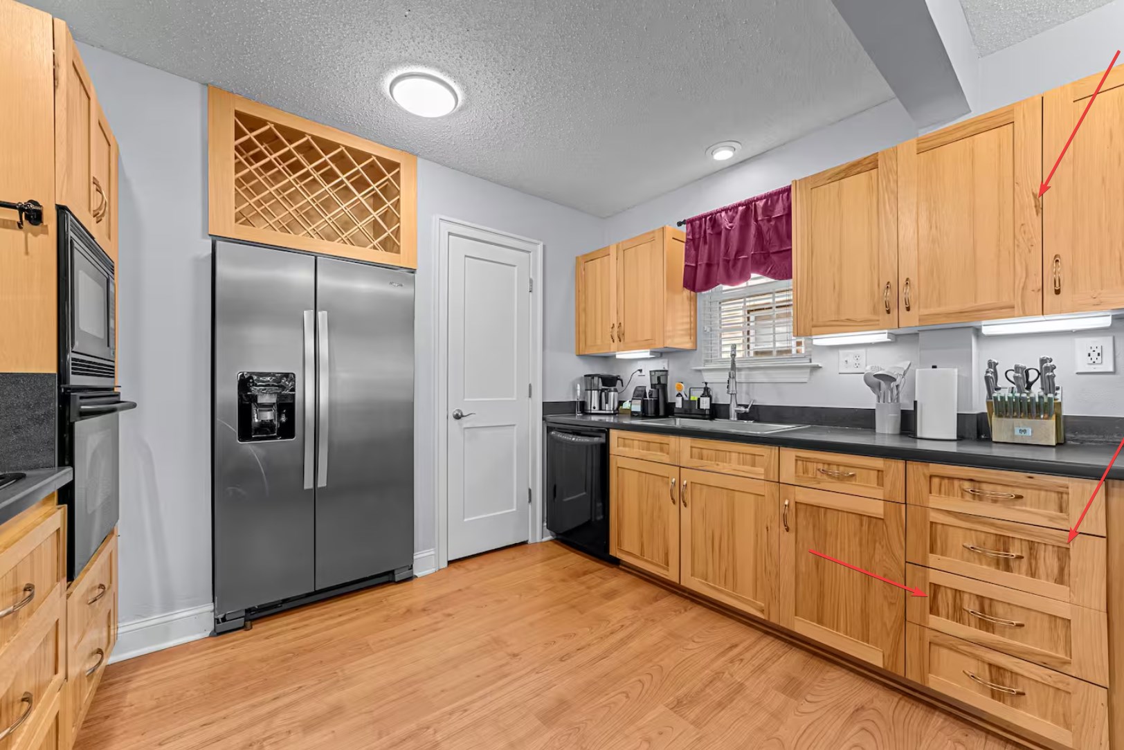
Zillow.com Photo of the Same Unit
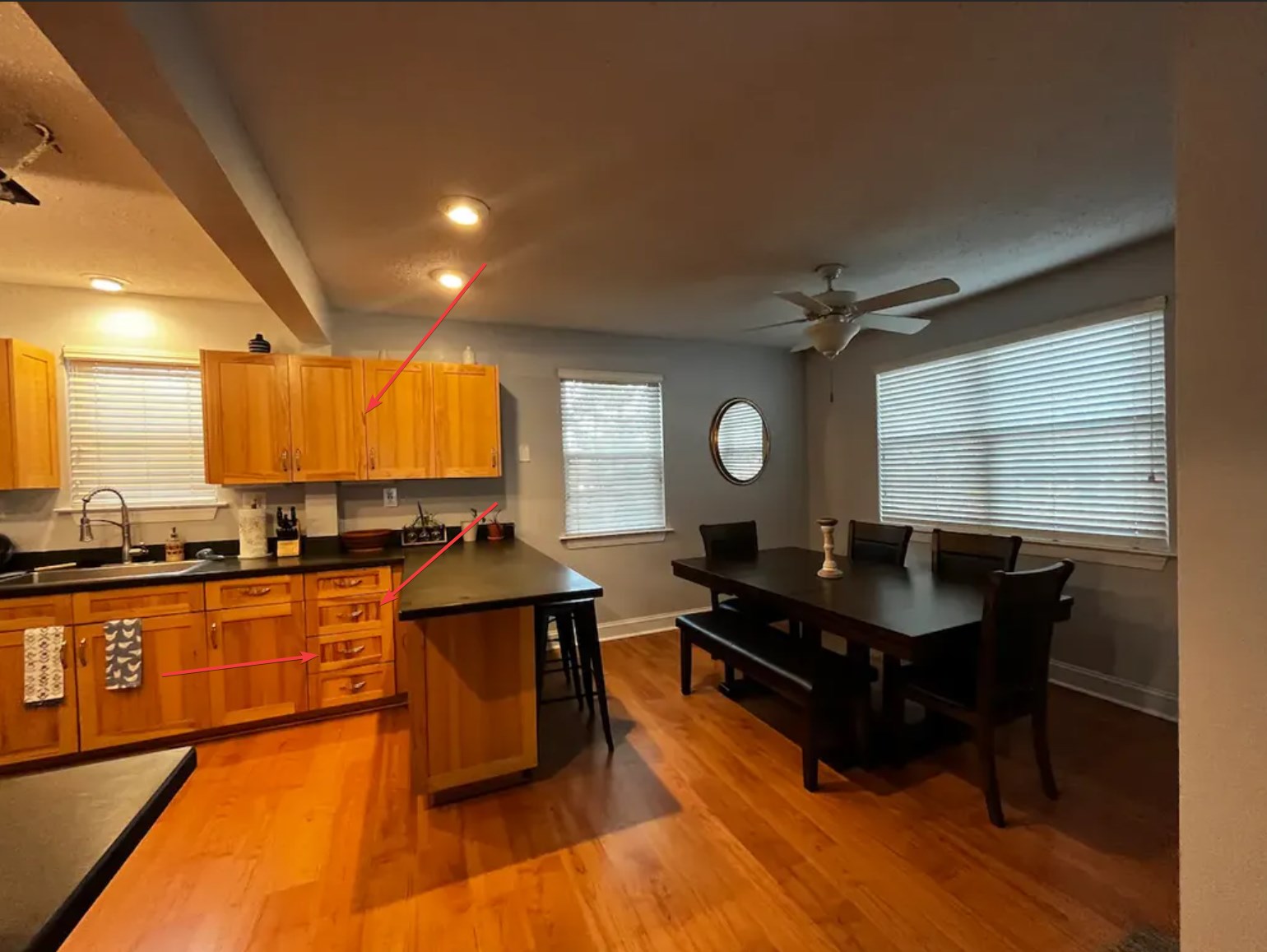
In this example, the wood grain on the cabinets in the host’s photos matches the cabinets in photos from a real estate listing.
There Is No Single Formula
These are only some of the techniques an analyst can use. Listings vary a lot in what they reveal, and there are many other ways to prove an exact address depending on the property and the evidence.
Analysts pick the strongest method for each listing.
The aim is an address that the evidence supports, not a best guess.
Step 4: The Address and Evidence Are Submitted
Once the analyst identifies the property, they submit a full identification record, not only an address.
The submission includes the address, parcel information and coordinates, along with the evidence for the match:
- Photo evidence comparing the listing with the identified property, annotated where needed to point out the matching features.
- A link to the source used as evidence, such as an assessor record, real estate listing, GIS record or mapping service.
Together these give a reviewer an evidence trail for the identification, instead of relying only on the analyst’s word.
Because the municipality’s registered rentals are already in VeriStay, the identified property is checked against the registry automatically as part of the same step.
Note: The values in these fields are for demonstration only and don’t correspond to a real property.
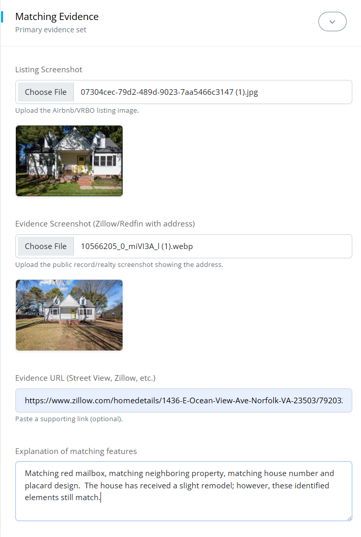
Evidence Submission, continued
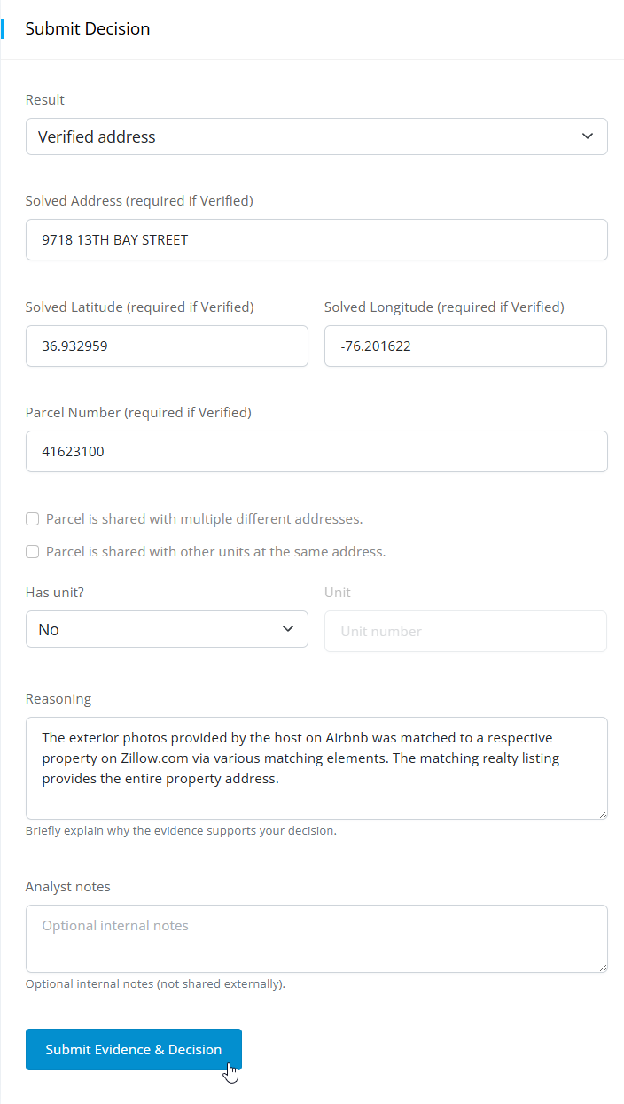
Step 5: Registered Properties Are Matched Automatically
If the identified address or parcel matches an existing STR registration, VeriStay recognizes it automatically. The listing is marked:
Solved
and also:
Compliant
The municipality can now follow the chain:
Online listing → Exact property → Parcel → Existing STR registration
The analyst doesn’t have to search the registry by hand for each address.
Step 6: Listings Without a Match Are Reviewed
A failed automatic match does not mean the property is unlicensed. It sends the listing to a second check.
Listings without a direct match go to VeriStay’s license review queue. A reviewer looks at nearby registered rentals, different spellings of the address, unit numbers, related parcels and other possible connections.
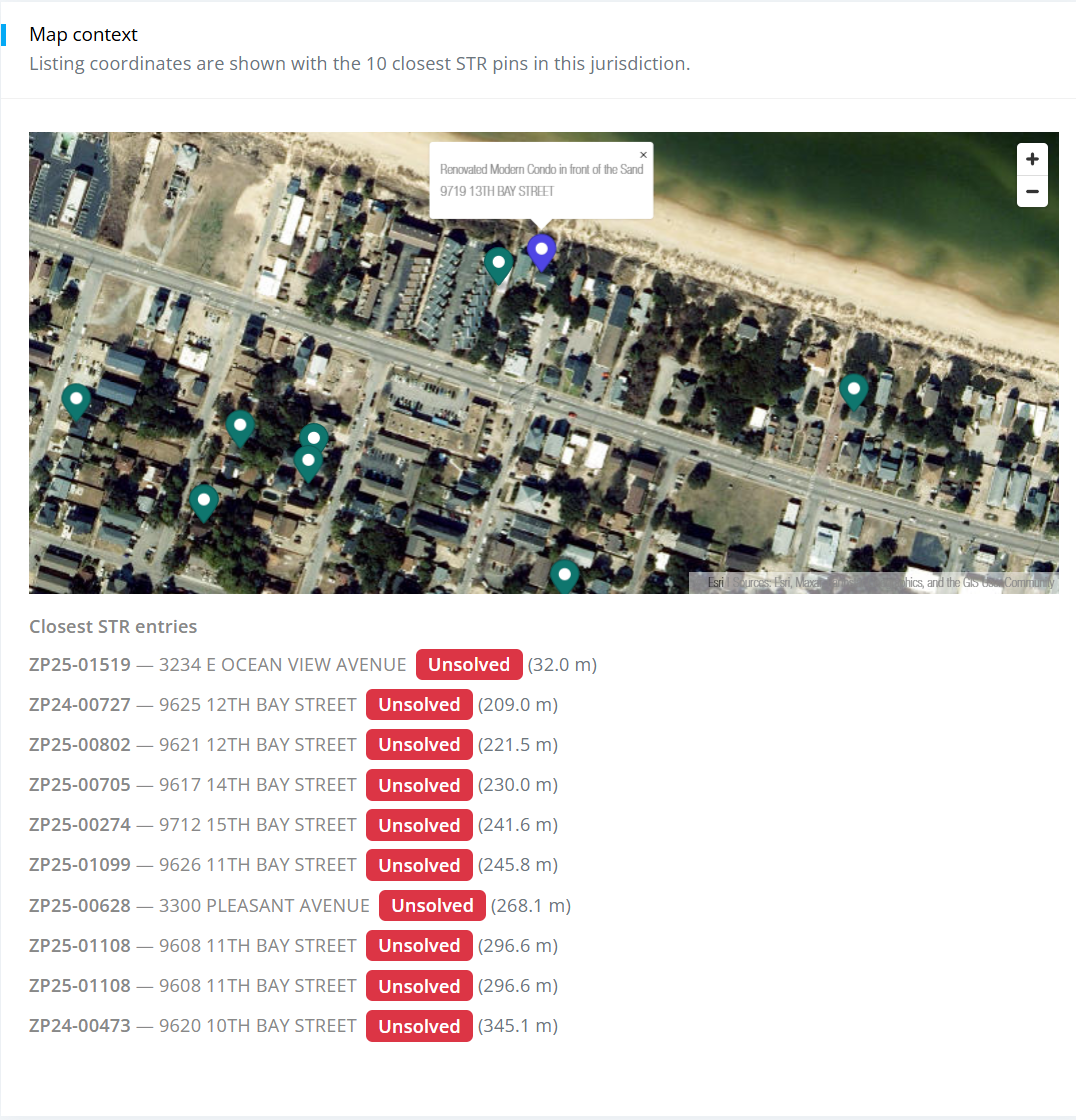
The review screen shows, for example, how many registered rentals share the same house number, and a map of registered rentals near the property.
The reviewer checks whether:
- a registration uses a slightly different address or unit format
- a nearby or related parcel explains the listing
- a building has a registered unit that matches the rental
- any other registration plausibly belongs to the property
A failed automatic match starts a review. It is never treated as proof of noncompliance.
If the reviewer finds a valid match, the listing is linked to that registration. If no plausible registration is left after review, the listing is marked unlicensed.
This keeps two decisions separate: where the rental is, and whether it is registered.
Review Queue
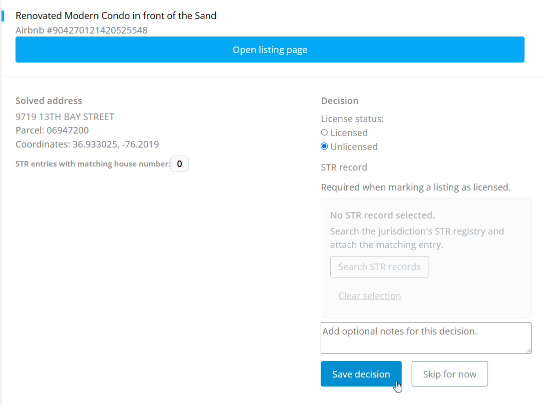
Review Queue Map With Nearby Registered Rentals
Step 7: Unlicensed Listings Are Checked for Past Activity
Once a property is confirmed as unlicensed, VeriStay goes back to the rental platform and collects its history.
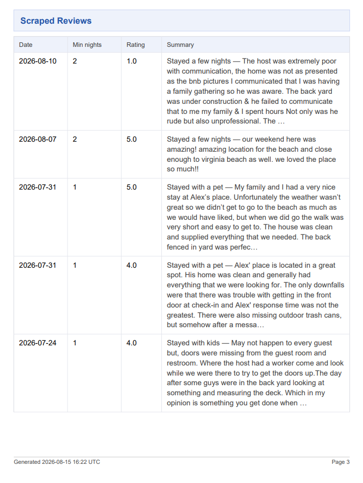
Guest reviews matter most, because they show the property was actually rented, not only advertised.
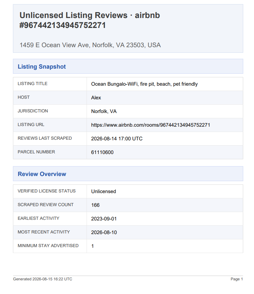
Review data can show:
- The earliest documented guest stay
- The most recent activity
- The number of unique guest reviews
- An estimate of stays based on those reviews
A listing found today may have been operating for months or years. The earliest review shows how far back the documented activity goes. Since not every guest leaves a review, the review count is a conservative minimum for the number of stays.
Example
75 unique guest reviews document at least 75 stays at the listing.
The real number may be higher. This history is useful when the length or frequency of unlicensed operation affects back fees, taxes, penalties or other enforcement decisions.
Note: This report has since been redesigned. The version shown here is for demonstration only.
Collected Guest Reviews
Step 8: The Municipality Gets the Data
At the end, the municipality has a structured record instead of an anonymous listing:
| Data | Result |
|---|---|
| STR listing | Collected |
| Exact address | Identified |
| Parcel | Identified |
| Exact unit | Identified when the evidence allows |
| Registration status | Checked automatically, reviewed when needed |
| Identification evidence | Saved |
| Earliest documented stay | Collected when available |
| Review history | Collected when available |
| Documented stays | Counted when available |
The municipality can get this data however suits it: through the API, as CSV exports, as GIS-ready data, as PDF evidence reports or as scheduled reports.
From Identification to Enforcement
VeriStay finds and organizes the information.
The municipality decides what happens next.
Depending on its ordinances, fees and enforcement powers, a municipality might use the data on confirmed unlicensed rentals to:
- contact operators and bring properties into compliance
- collect registration or license fees, including back fees
- review lodging or occupancy tax compliance
- issue notices of violation or civil penalties
- update its STR registry
- decide where to focus enforcement
VeriStay doesn’t decide penalties. It gives the municipality what it needs to apply its own rules to properties it couldn’t connect to an address before.
The Whole Workflow
Collect → Investigate → Identify → Match → Review → Confirm → Document → Export
Each step builds on the one before. The listing starts as an anonymous ad and ends as a verified property record with evidence, a registration status and, where available, its rental history.
Summary
Finding the address is the first step. The value to a municipality comes from what that address connects to: the parcel, the registration status, the evidence and the rental history.
VeriStay does the research that links a listing to a property and a license decision, and gives the municipality the results as data it can use.