A Listing Page Can Hold More Than It Shows
Rental websites often don’t show a property’s full street address on the listing page. But the HTML sent to the browser sometimes contains structured property details, including the address.
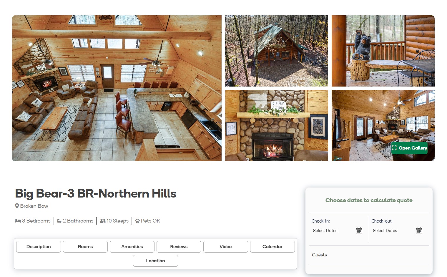
Take, for example, the Big Bear-3 BR-Northern Hills cabin listing published by Hidden Hills Cabins in Broken Bow, Oklahoma.
The page itself only says it’s a three-bedroom cabin in Broken Bow. Here’s what the page’s source code shows.
Step 1: Open the Public STR Listing
Open the listing page: Big Bear-3 BR-Northern Hills on Hidden Hills Cabins.
Open the STR listing in a web browser
Step 2: Open the Page Source
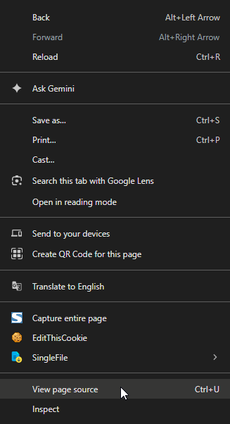
Next, open the page’s HTML source. In most desktop browsers, right-click the page and choose View Page Source, or press Ctrl+U.
This shows the HTML and embedded data the browser uses to build the page.
Step 3: Search for Common Location Terms
Instead of reading the whole file, use the browser’s find (Ctrl+F) to search for common location terms:
- address
- latitude
- longitude
- coordinates
- city
- zip
Field names differ between sites, so one term may find nothing while another leads straight to the address.

Step 4: Inspect the Matching Source Block
Here, searching for latitude leads to a unit-data element that holds the property’s address, coordinates and other details.
What the Search Reveals
<div class="abe-column abe-unit-info" id="unit-data"
     data-unit-id="2"
     data-unit-property-code="2"
     data-unit-name="Big Bear-3 BR-Northern Hills"
     data-unit-type="Cabin"
     data-unit-slug="Big_Bear-3_BR-Northern_Hills-2-15"
     data-unit-address1="167 Almond Lane"
     data-unit-address2=""
     data-unit-city="Broken Bow"
     data-unit-state="OK"
     data-unit-zip="74728"
     data-unit-latitude="34.20249030"
     data-unit-longitude="-94.78884810"
     data-unit-beds="3"
     data-unit-baths="2"
     data-unit-sleeps="10"
     data-display-pageviews="false"
>
The location fields are easy to pick out:
| Field | Value |
|---|---|
| Street address | 167 Almond Lane |
| City | Broken Bow |
| State | OK |
| ZIP code | 74728 |
| Latitude | 34.20249030 |
| Longitude | -94.78884810 |
Nothing here is inferred from photos or the visitor map. The address is written directly into the listing’s HTML.
Step 5: Verify the Property Against County Parcel Records
The source code gives us an address: 167 Almond Lane, Broken Bow, Oklahoma 74728. Next we confirm, from a separate source, that this address is the property in the listing.
1Check for Existing Realty Listings
First we check real estate sites such as Realtor.com and Zillow. A current or past sale listing often has exterior photos that make the check easy.
Realty search result
There is no useful real estate listing for 167 Almond Lane, so we go to the county parcel database.
2Search the McCurtain County Parcel Database
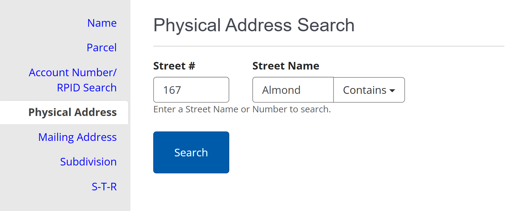
We open the McCurtain County property search on ACT Data Scout and search for the address from the listing’s source code.
3Open the Matching Parcel Record
The search returns one result for 167 Almond Lane. We open it to see the county’s property record.

4Locate the County’s Exterior Photograph
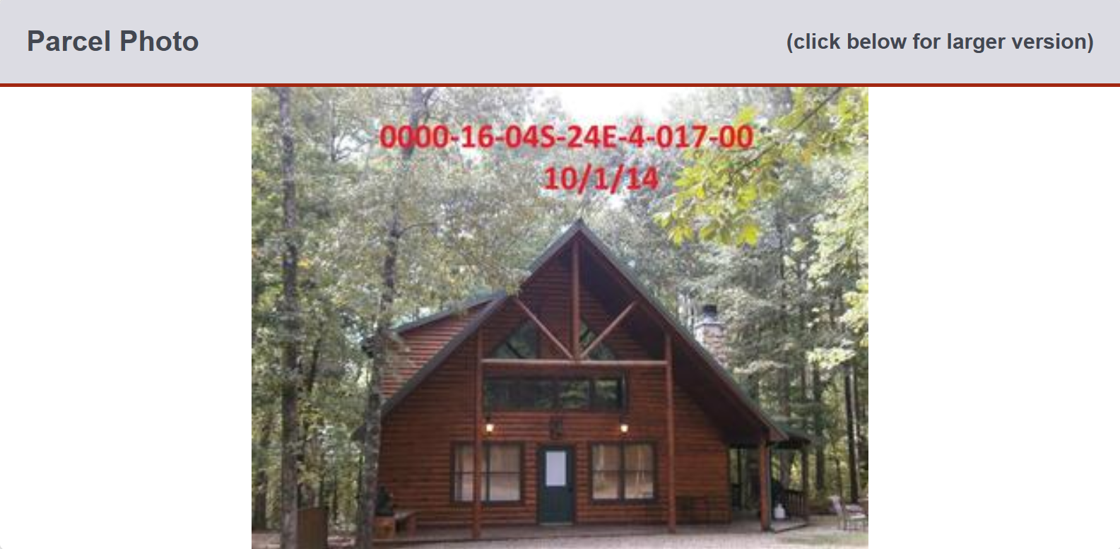
The parcel record includes an exterior photo of the property: an image tied to the address that doesn’t come from the rental listing.
5Compare the County Image With the STR Listing
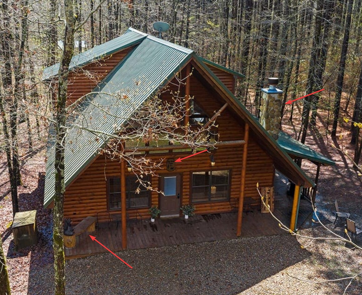
Now we compare the county photo with the listing’s exterior photos. Several details appear in both:
- A unique wooden bench on the front porch
- A stone chimney on the exterior of the cabin
- A black crest above the front door
Rental Listing: Exterior Photo
County Parcel Record: Matching Exterior
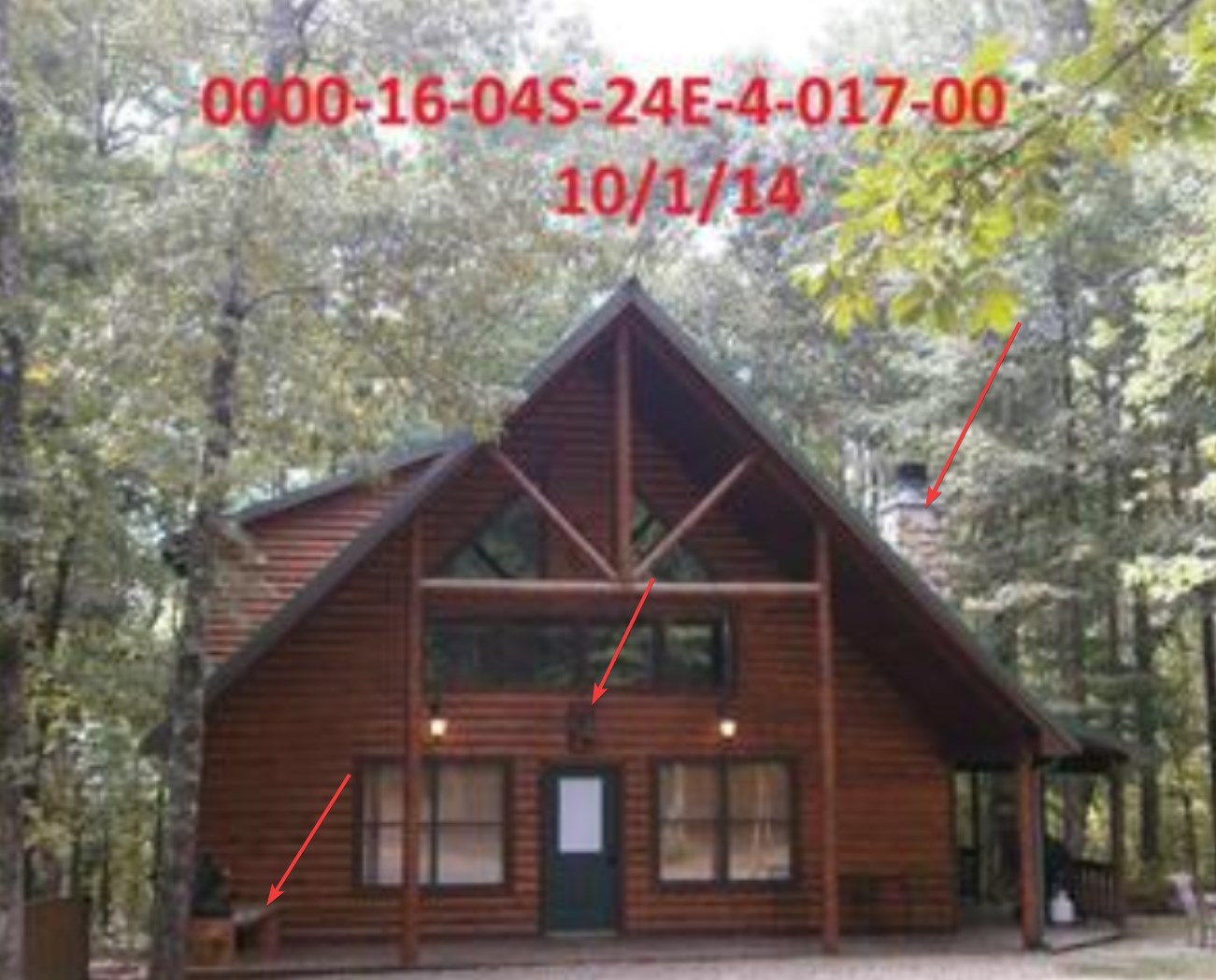
These matches tie the county’s record for 167 Almond Lane to the cabin in the listing.
Verification chain
Listing → address in the HTML → county parcel record → county photo → visual match
The HTML gives the address. The county record and the matching features confirm it is the advertised property.
- Open the public STR listing
- View the page source
- Search common location terms
- Inspect the matching HTML fields
- Verify the property through county parcel records and imagery
Why This Matters to Municipalities
For a compliance program, what matters is connecting an online listing to the property it advertises.
Where the location data is precise enough, a municipality can compare it with its GIS, parcel and licensing data. An address can be checked directly, and coordinates can be placed on parcel boundaries and then verified.
Location data in the source code can turn a hard-to-place listing into an address or parcel you can check against your records.
The Same Principle Extends Beyond HTML
Not every rental site puts location fields in the HTML. Many load the same information through network requests the page makes as it loads.
The idea is the same: whatever property data a site sends to the browser is another source of evidence for connecting listings to properties.
Scaling the Method Across STR Inventories
The example above follows one listing to a verified address. When a site builds all its property pages the same way, the method works across many listings.
Once you know which fields a site uses, you can collect them from all of its listing pages, standardize the addresses or coordinates, and compare them with local parcel and license records. Listings that match a licensed property can then be set aside, leaving the rest for review.
Some sites expose full addresses; others give only coordinates or part of the location. The less a site gives, the more checking is needed, using parcel databases, assessor photos, GIS data and other public records.
So the method is useful for whole inventories, not only one-off investigations.
At scale
Applied across a site, this turns many listings into property records you can compare with your license data.